


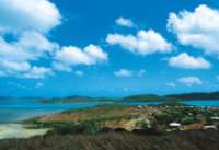
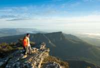
Parc national de Purnululu - Bungle Bungle
Au coeur du Kimberley : Bungle Bungle Purnululu National Park
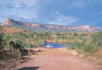
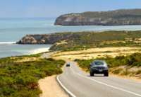
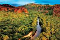
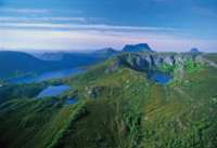
Situé au cœur du Kimberley, le parc national de Purnululu se rejoint par une piste 4x4 accessible depuis la Great Northern Highway, à 250 km au sud de Kununurra et 115 km au nord de Halls Creek. Le parc national de Purnululu découvert en 1980 et classé au patrimoine mondial est l’un des secrets les mieux gardés d’Australie. C’est aujourd’hui un incontournable dans un voyage au Kimberley. Le parc est ouvert d’avril à octobre.
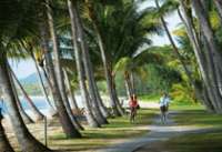
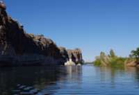
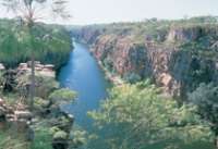
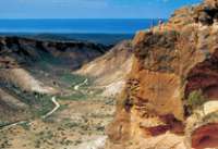
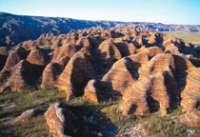
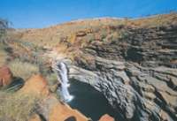
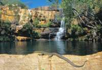
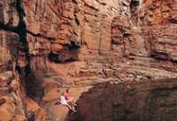
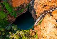
Les Bungle Bungle offrent le spectacle d’impressionnants dômes striés d’orange (silice) et noir (lichen) créant un paysage hors du commun. Rien de mieux qu’un vol panoramique pour se rendre compte de l’immensité de cette merveille de la nature. Survolez des gorges étroites et escarpées, bordées de palmiers majestueux et ponctuées à la saison des pluies de cascades et de piscines naturelles paisibles. Au coeur du massif des Bungle Bungle, explorez lors d’un safari ou circuit en 4x4 les gorges au nord, Minipalms Gorge, Froghole et Echidna Chasm. Au sud, Cathedral gorge et Piccaninny ne sont accessibles qu’aux bons marcheurs.

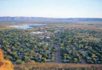
Ce camp est situé au coeur du Parc National de Purnululu (Bungle Bungle), à environ 312 km au sud de Kununurra et à mi-chemin entre les gorges du Nord et Cathedral Gorge. Sur Bellburn Creek, le Bungle Bungle Wilderness Lodge est le point de départ idéal pour découvrir la ...
Simpsons Gap

Dampier Archipelago

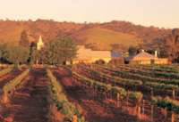
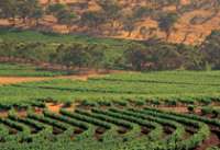
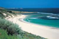
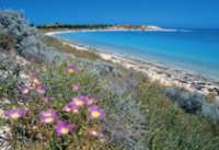
Leeman

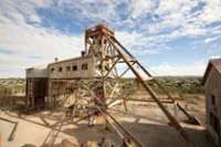
Mt Whaleback

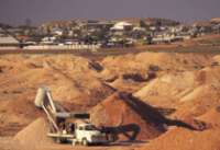
Mines de Newman
Waddy Point

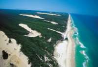
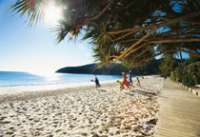
Rainbow Beach

Tin Can Bay

Lake McKenzie

Wungul Sandblow

Emerald Creek Falls

Eurimbula NP

Minerva Hills Np

Keswick Island

Springsure

Capella

Cania Gorge NP

Capricorn Caves

Bowen

Nebo

Brampton Island

Eungella NP


Cette île de corail est située juste sur le récif au large du Queensland, à environ 72 km au nord-est de Gladstone, soit à 2 heures de bateau ou à 30 minutes d’hélicoptère. Heron Island est une petite île recouverte d’une forêt dense, et ...

Située à 30 minutes de vol de Bundaberg et 1 h 20 de Brisbane sur la partie Sud de la Grande Barrière de Corail, Lady Elliot Island est une île corallienne réputée pour la richesse de ses récifs et la présence des majestueuses raies manta et tortues. Lady Elliot Island Eco Resort propose des hébergements les pieds dans ...
Mon Repos

Agnes Water

Town of 1770

Gladstone

Rockampton

Yeppoon

Blackdown Tableland NP

Hamilton Island

Heart Reef

Langford Island

Cape Hillsborough NP
Wallaman Falls

Hinchinbrook Island

Norman River

Burketown

Cobbold Gorge

Forsaith
Paluma Range

Little Crystal creek
Paluma Range NP

Crystal creek
Girringun NP

South Molle Island

Hells Gate

Dill Doll Rocks
Charters Towers

The Burdekin


Hidden Valley cabins & Platypus safari, est un éco-resort primé, et aussi le premier resort en Australie à s'engager pour le zéro carbone ayant recourt à l'énergie solaire à 100%. Le resort est située à 1h30 au nord-ouest de Townsville, ...
Lakefield NP

Lawn Hill NP

Constance Range
Lawn HIll Gorge

Lockhart

Horn Island

Eliott Falls

Cap York

Annan Gorge

Split Rock - Laura

Northernmost Point

Low Island

Kuranda

Green Island

Bloomfield Falls

Daintree National Park

Cape Bedford

Wooroonooran NP

Rafting - Tully River

Dunk Island

Bloomfield Track

Mossman Gorge

Cooktown

Cape Tribulation

Undara Volcanic NP

Atherton Tableland

Zillie Falls
Survol de la Grande Barriere

Agincourt Reef

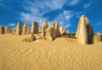
Wolfe Creek Meteorite

Scarborough

Freemantle

Lake Ballard

Kata Tjuta - Monts Olga

Yourambulla


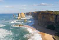
The twelve apostles

Coorong

Naaracoorte

Robe

Coonawarra

Mt Gambier


Great Otway National Park

Torquay

La plage de Bells beach à Torquay
Warrnambool

Port Fairy

Seals Bay

Ramarkable Rocks

Kelly Hill

Little Sahara

Penneshaw

Lac Eyre

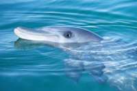
Leafy Seadragon

Snelling beach

Adelaide Hills

Murray River

Wilpena Pound


Leigh Creek

Arkaroola

William Creek

The Breakaways

Painted Desert

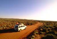
Simpson Desert

Strzelecki Track

Oodnadatta

Lake Gairdner

The Great Australian Bight

La Grande Baie australienne
Gawler Ranges

Ceduna

Hopkins Island

Nager avec les Lions de mer à Hopkins Island
Nullarbour Highway

Innes National Park


Mt Baw Baw

Ninety Mile Beach

Lakes Entrance

Croajingolong National Park

Walhalla

Yarra Valley

Dandenong Ranges

Lake Daylesford

Shepherds

Ferme de Lavande à Shepherds
Goldfields

Ballarat

Bendigo

Albury

Lake Mulwala

Murray River

Alpine National Park

Mt Hotham

Lake Jindabyne

Beechworth

Kosciusco - Alpine Way

Eden

Cape Conran

Pambulla

Tomakin

La Sapphire coast

Kangaroo Valley

Hunter Valley

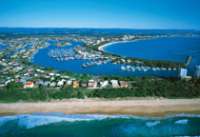
Port Stephens

Grand Pacific Drive

Dorrigo National Park

Coffs Harbour

Wollemi National Park


Myall Lakes National Park

Mutawintji National Park

Menindee Lakes

Mungo National Park

Silverton

Arltunga Tourist Drive

Litchfield National Park

Mary River National Park

Tiwi Islands

Mataranka

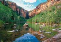
Nourlangie Rock

Ubirr Rock

Gunlom Falls

Barramundie Gorge

Twin Falls

Jim Jim Falls

Yellow Waters

17 Mile Falls - Tjabula Trail

Douglas River - Daly River

Timber Creek

Keep River National Park

Injalak Hill - Gunbalanya

Cobourg Peninsula

Black Point
Garig Gunak Barlu National Park

Découvrez, en 3 jours, des lieux hors des sentiers battus, où la présence aborigène remonte à plus de 50 000 ans, lieu où vous échappez aux pressions de la civilisation.
Fogg Dam

Devil’s Marbles

Palm Valley - Finke gorge National Park

Rainbow Valley

West MacDonnel Ranges

East MacDonnel Ranges

Barrière à Dingo

Ormiston Gorge

Trephina Gorge

Glenn Helen Gorge

Mt Connor


Port Denison

The Stromatolites - Hamelin pool

Busselton Jetty

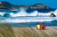
Whale Watching à Busselton

Forêt de karris - Boranup forest

Sugarloaf Rock

Bibbulmun Track - Albany

La côte d’Albany

Fitzgerald River National Park

La plage de Quoins Head
Leeuwing Naturalist National Park

La plage de Redgate Beach
D’Entrecasteaux National Park

La plage de Mandalay
Valley of the Giants

Tree top Walk
Cape Le Grand National Park

William Bay National Park

Kookynie

Laverton

Leonora

Kalgoorlie

Goldfields

Cape Le Grand National Park

Thistle cove
Conto Springs Beach

Striling National Park

Bluff Knoll Walk
Mount Ragged - Cap Arid National Park

Mount Barren - Fitzgerald River National Park

Lake Cave - Mammoth Cave

Dunes - Fitzgerald River National Park

Greenbushes

Willian Bay National Park

Fitzgerald River National Park

Bunbury

Cape Leeuwin

Mount Barker

Cape Range National Park

Yardie Creek
Cape Range National Park

Shothole Canyon
Muiron Islands

Shell Beach - Shark Bay

François Peron National Park - Shark Bay

Bottle Bay
François Peron National Park - Shark Bay

Big Lagoon
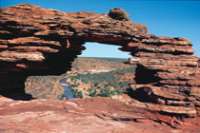
Kalbarri National Park

Kalbarri National Park

Eagle gorge coastline
Kalbarri National Park

Hawk’s Head look out
Kalbarri National Park

Look Out Ross Graham
Hutt River Province

Lancelin

Port Denison

Dunes de Lancelin

Jurien Bay Marine Park

Yanchep National Park

Rottnest Island

Swan Valley

Coolie

Waves Rock - Hyden

Bingara

Cowra

Port Macquarie

Crowdy Bay National Park

Diamond Head
Bourke

North Bourke Bridge 1880.
Murgon

Bunya Mountains NP

South Burnett

Maryborough

Caloundra

Mapleton Forest

Montville

Maleny

Glass House Mountains

Hervey Bay

Ferme de chameaux

Springbrook NP

Lamington NP

Stradbroke Island

Stradbroke Island

Moreton Island

Moreton Island

Paturages - Flinders island

The docks - Flinders Island

Trouser Point

Mt Lot

Stanley


Queenstown

Derwent River

Strahan

Lake St clair

Overland Track

Burnie

Cataract Gorge

Tamar Valley

Bay of Fires

Bridestowe Estate

St Helens

Freycinet NP

Bicheno

Maria Island

Mt Field NP

Huon Valley

Bruny Island

Mt Wellington

Tasman Peninsula

Port Arthur


Mona Museum

Coolangatta

Surfer paradise

Osmond Ranges

Dimond Gorge - Fitzroy River

Mitchell Falls

Horizontal waterfall

Bell Gorge

Maning Gorge

Windjana Gorge NP

Tunnel Creek

China Wall - Halls Creek

Geikie Gorge

Pentecost River

Cockburn Range

Emma Gorge

Lake Argyle

Cape Leveque

Montebello Islands

Mt Bruce

Millstream-Chichester NP

Python Pool
Karijini NP

Fern Pool
80 Mile Beach

Millestream Chichester NP

Requin Baleine

Lighthouse Bay

Beagle Bay

TIlba Tilba

Gipsy Point

Accès et campings
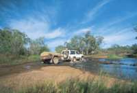
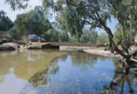
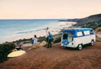
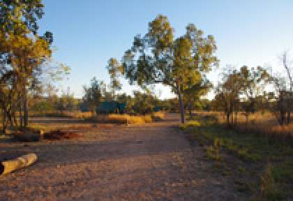
Accessible au départ de Kununurra en avion ou depuis la Great Northern Highway par une piste assez chaotique de 52 km qui mène à l’entrée du parc. Cette piste rude et étroite est accessible uniquement en 4x4, compter 2h30 minimum. Au coeur du parc, vous n ’aurez aucune infrastructure hôtelière, seulement 2 sites de camping au confort sommaire. Le Kurrajong Camp est la base idéale pour explorer la partie nord du massif, et le Walardi Camp au sud.
Le centre des visiteurs ferme à 16h, prévoyez d’arriver avant pour votre emplacement.

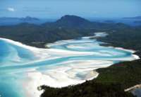
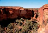
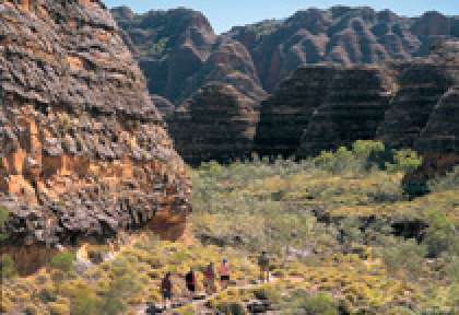
Purnululu et ses dômes
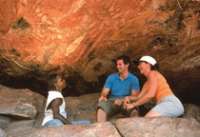
Explorez ces dômes impressionnants souvent comparés à des ruches d’abeilles géantes. Partez en randonnée à pied à travers les gorges caverneuses façonnées depuis plus de 350 millions d’années. Faites une excursion à bord d’un 4x4 et campez à la belle étoile, ou passez quelques jours dans un campement en pleine nature parmi les merveilles géologiques de Purnululu. Pour plus de confort, dormez au Bungle Bungle Wilderness Lodge. 2 ou 3 jours au coeur du parc permettent de découvrir l’art rupestre, les animaux rares, les piscines naturelles tropicales bordées de palmiers et les gorges rocailleuses. N’oubliez pas de réserver votre survol en hélicoptère au-dessus des dômes. Un moment magique !
Les principaux sites
Dans la partie sud du parc, partez en randonnée à Cathedral Gorge et découvrez ses secrets acoustiques naturelles. Un pittoresque sentier pédestre de 3 km vous conduit à Piccaninny Creek, puis vers l’impressionnante Piccaninny Gorge où vous pouvez camper pour la nuit. Dans le nord de Purnululu, vivez une expérience totallement différente à travers des gorges beaucoup plus étroites. Une marche facile de 2 km mène au site d’Echidna Chasm, entouré de murs rocheux culminant à une centaine de mètres de chaque côté. Accédez à la gorge de Mini Palms, une randonnée de 5 km aller et retour qui abrite des palmiers Livingstonia élancés et une grotte de fertilité traditionnelle aborigène.
Bungle Bungle Wilderness Camp
Hôtel 3* - dès 393 €
En matière d’hébergement dans le parc national de Purnululu, le Bungle Bungle Wilderness Lodge offre le confort maximal. Ses bungalows toilés en plein cœur du parc national de Purnululu sont conçus pour que vous ayez vraiment l’impression de vivre au milieu du bush et pourraient bien être l’un des temps forts de votre séjour. Le Bungle Bungle Wilderness Lodge est ouvert d’avril à octobre. (lire la suite)


Survol des Bungle Bungle
Excursion demi-journée - dès 428 €
Au coeur du parc vous pouvez prendre un survol des Bungle Bungle en hélicoptère d’une durée de 30 minutes. Sinon, optez pour un survol en avion à partir de Kununurra, qui inclut également un passage au-dessus du lac Argyle. (lire la suite)

De Broome aux Bungle Bungles
Circuit camping - dès 1405 €
En 5 jours seulement, découvrez des sites emblématiques du Kimberley, avec le Parc national de Purnululu et ses célèbres Bungle Bungle, ainsi que Windjana Gorge et Tunnel ... (lire la suite)

Safari dans le Kimberley en camping – départ Broome
Circuit - 9 nuits - dès 2109 €
À bord d'un bus 4x4, partez 10 jours en safari, à la découverte de la région du Kimberley. De Broome à Darwin, passez vos nuits en ... (lire la suite)

Sur la piste légendaire de Gibb River
Circuit camping - dès 2813 €
En 11 jours, partez à la découverte du Kimberley en bus 4x4 et camping. Une aventure inoubliable à travers l'Outback, sur la légendaire Gibb River Road. Depuis Broome, ... (lire la suite)

Le meilleur du Kimberley
Circuit camping - dès 3639 €
Vivez l'aventure ultime en safari camping pendant 14 jours, explorant les incontournables du Kimberley, dont le Mitchell Plateau avec un survol en hélicoptère. Partez ... (lire la suite)


